What is the status of our orbital environment in 2026?
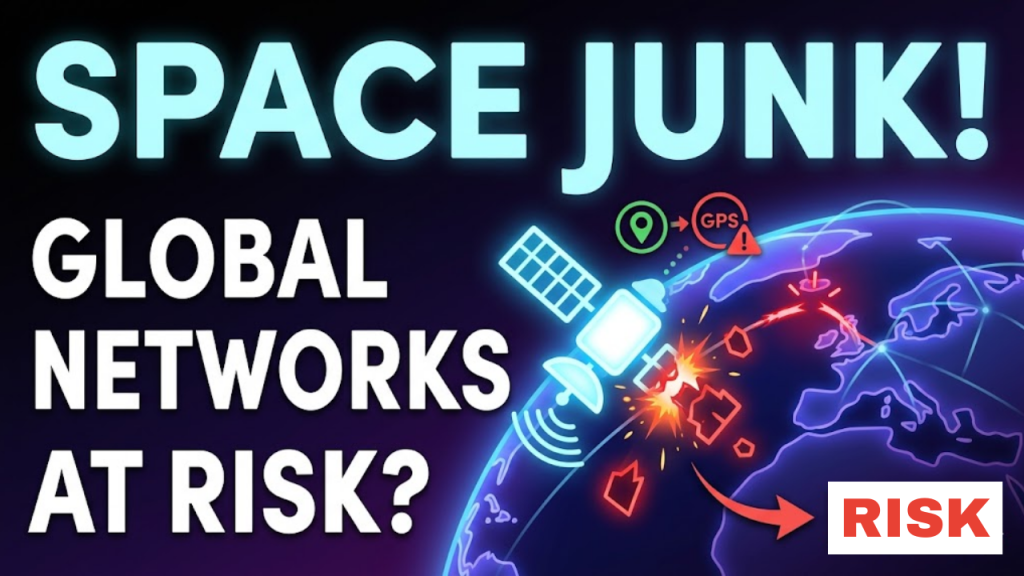
As of April 2026, Earth orbit hosts over 15,000 active satellites. This density has created an environment where the risk of collision is no longer a distant concern, but a daily operational hazard. Space junk, or orbital debris, consists of millions of fragments traveling at speeds up to 22,000 miles per hour. A single paint fleck moving at these velocities carries the kinetic energy of a hand grenade. If these fragments collide with critical infrastructure, they threaten the backbone of our global economy: the GPS systems that synchronize our financial networks and the data satellites that provide global connectivity.
In 2026, we are operating on the edge of the Kessler Syndrome, a catastrophic chain reaction where collisions create more debris, which then triggers more collisions, eventually rendering entire orbital bands unusable for generations.
The Cascading Impact: Why GPS and Data Are Vulnerable
We rely on satellites for more than just navigation. In 2026, our entire digital infrastructure depends on the precise timing provided by GPS constellations.
| System | Dependency | Risk Factor |
| Global Finance | GPS Timing Synchronization | High (System-wide drift/shutdown) |
| Telecommunications | Satellite Internet (LEO) | Moderate (Latency/Signal loss) |
| Aviation/Logistics | Precise Navigation | High (Routing failure/delays) |
| Power Grids | Time-stamping for maintenance | Moderate (Synchronization errors) |
The Kessler Syndrome Effect
The Kessler Syndrome is the most dangerous scenario for 2026 infrastructure. When one satellite disintegrates, it creates thousands of new projectiles. These projectiles strike other satellites, creating a “positive feedback loop” of destruction. Researchers have even developed a CRASH Clock to estimate how quickly this could happen; their calculations suggest that if satellite maneuverability were lost today, a major collision could begin within a mere 2.8 days.
3 Pillars of Orbital Debris Mitigation
To protect our GPS and data networks, the industry is shifting toward three core solutions in 2026.
1. Active Debris Removal (ADR)
Companies like ClearSpace are pioneering missions to physically capture defunct satellites. By attaching a robotic arm to “space junk,” they can force it to de-orbit and burn up in the atmosphere. This is the only way to reduce the total mass of debris in popular orbital “highways”.
2. Autonomous Collision Avoidance
Modern satellites, particularly in the Starlink constellation, now use onboard AI to perform automatic maneuvers. These systems monitor debris paths 24/7 and adjust the satellite position to avoid impacts of as little as three in 10 million. This automation is now the industry standard for satellite longevity.
3. Orbital Shell Management
Instead of launching every satellite into the same path, operators are shifting to “shells.” By grouping satellites into specific altitude bands (e.g., 270 miles, 290 miles, 310 miles), companies reduce the density of objects in any single orbital path. This is similar to adding lanes to a highway to reduce traffic accidents.
Frequently Asked Questions (FAQ)
1. Can we just clean up the junk?
Technically, yes. Economically, it remains challenging. Missions like ClearSpace-1, launched in 2026, cost millions of euros to remove a single object. We need order-of-magnitude improvements in capture technology to scale this cleaning process.
2. Does space junk affect my phone?
If a major collision wipes out a segment of the satellite network, you might experience GPS inaccuracy or slower internet speeds. Your phone does not “receive” debris, but the satellites it talks to might be offline.
3. What is the CRASH Clock?
The Collision Realization and Significant Harm (CRASH) Clock is a metric created by space scientists to track the “time to disaster.” As of 2026, it indicates that a catastrophic collision event is statistically imminent if we lose control over traffic management.
4. Why do I see an Apple Security Warning on my satellite tracking apps?
If your tracking software attempts to intercept system-level GPS data or uses non-standard network protocols to monitor satellite paths, you may trigger an Apple Security Warning on your iPhone.
5. Who is responsible for cleaning up space?
International law is weak. The UN provides non-binding guidelines, but no global treaty forces companies or nations to clean up their defunct satellites. This is a major regulatory gap in 2026.
6. Are there laws against hitting satellites?
Yes, but proving fault is nearly impossible. If a defunct satellite from 1980 hits your new 2026 satellite, the original operator may not even exist, leaving you with the repair bill.
7. What happens to humanity if we lose LEO?
We lose internet, global navigation, weather forecasting, and military surveillance. We would essentially be confined to ground-based technologies, causing a massive, multi-decade economic shock.
8. How can a small piece of junk destroy a satellite?
At orbital speeds (22,000 mph), a 10cm piece of aluminum carries the force of a truck bomb. There is no armor currently in use that can survive such an impact.
Final Verdict: Traffic Management is the Key
In 2026, space is no longer an infinite void; it is a congested highway. Protecting our GPS and data networks requires international cooperation, automated traffic management, and the rapid deployment of debris-removal technology. Security in the 21st century now extends 500 miles above our heads.
Ready to explore more about our infrastructure? Check out our guide on Zero-Trust Architecture for Web Developers or learn how to optimize your web performance in Interaction to Next Paint (INP): The New Core Web Vital.
Authority Resources
- GovTech: Orbiting Space Junk Poses Threat to GPS – A report on the 2026 status of space debris and infrastructure vulnerability.
- ScienceDaily: Low-Earth Orbit is 2.8 Days from Disaster – Detailed findings on the CRASH Clock and collision risks.
- NASA: Orbital Debris Program Office – The official NASA resources on debris tracking and mitigation.
- ESA: Space Safety – About Space Debris – Technical documentation on fragmentation events and collision history.