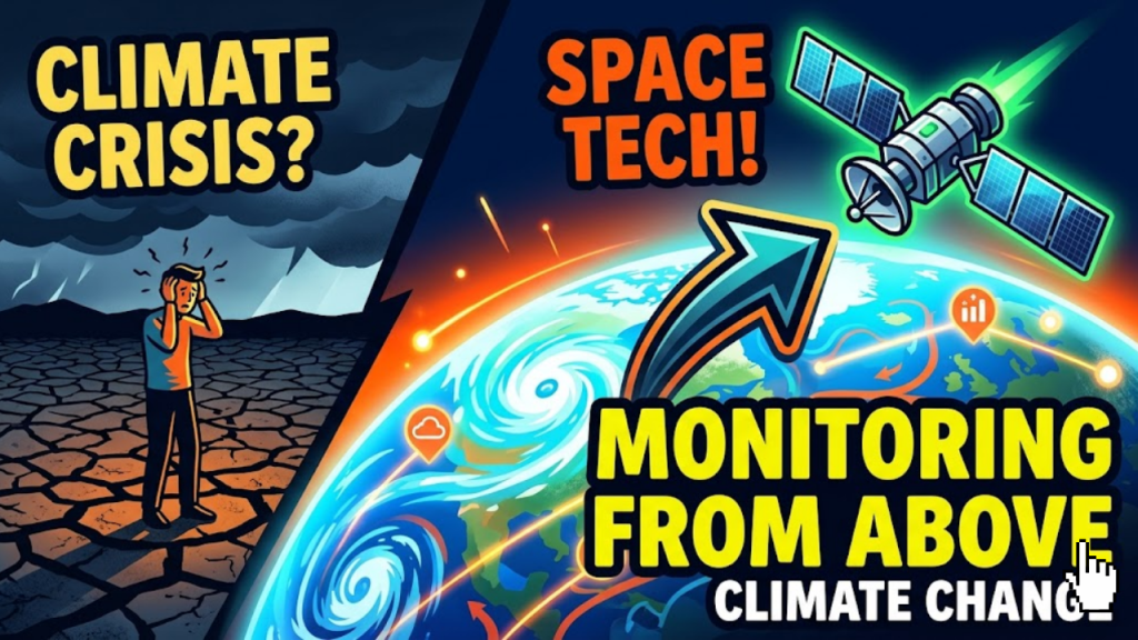
How does space tech track climate change in 2026?
The planet is monitored by a vast network of Earth Observation (EO) satellites. These instruments function as our global sensors. In 2026, we utilize thousands of satellites that continuously scan the Earth to measure critical variables, such as sea-surface temperatures, carbon dioxide levels, and polar ice thickness. Unlike traditional ground-based monitoring, this orbital perspective provides a holistic view of the planet, allowing scientists to track changes in real-time across the entire globe.
Space tech serves as our early warning system. By gathering this data, we can validate climate models, predict extreme weather, and ensure global policy compliance.
3 Ways Space Tech Revolutionizes Climate Data
In 2026, the power of space tech lies in the combination of high-resolution sensors and advanced analytics.
1. High-Resolution Hyperspectral Imaging
Traditional satellites capture data in a few spectral bands. In contrast, new missions like CHIME (Copernicus Hyperspectral Imaging Mission for the Environment) capture data across hundreds of narrow bands.
- The Benefit: This allows us to monitor the biophysical properties of crops and the organic content of topsoil, helping farmers adapt to droughts and improve food security.
2. Precise Greenhouse Gas Monitoring
Tracking emissions is no longer about estimates. The CO2M (Copernicus Anthropogenic Carbon Dioxide Monitoring) mission, launching and scaling in 2026, provides an independent source of information to measure human-made emissions.
- The Strategy: By combining satellite observations with ground-based modeling, we can now distinguish between natural carbon sources and human-made pollution, making environmental policy significantly more transparent.
3. AI-Driven Data Synthesis
Satellites generate petabytes of complex data daily. In 2026, AI is the engine that turns this raw noise into actionable insights.
- The Strategy: Machine learning models now automatically identify wildfires, track deforestation, and predict flood risks at unprecedented speeds. This automation allows us to react to environmental disasters as they unfold.
Key Climate Monitoring Missions (2026)
| Mission | Primary Focus | Climate Impact |
| CO2M | CO2 and Methane levels | Tracks human emissions for policy |
| CIMR | Sea-surface temperature/salinity | Monitors Arctic melt and ocean health |
| CRISTAL | Polar ice/snow topography | Measures sea-level rise potential |
| LSTM | Land surface temperature | Manages drought and urban heat islands |
Frequently Asked Questions (FAQ)
1. How does space tech affect my daily life?
Space data powers the weather forecasts you use, the agricultural supply chains that provide your food, and the policies that keep your air and water clean. It is the invisible infrastructure of a sustainable future.
2. Can satellites see everything?
No. While they provide global coverage, they still have limits on spatial resolution and cloud penetration. However, by combining data from multiple orbits and sensors, we can now “see through” most obstacles.
3. Is space tech contributing to climate change?
It is a valid concern. The launch industry and the growing number of satellites create debris and consume energy. However, the 2026 mandate is “responsible scale,” where missions focus on high-impact data to justify their launch footprint.
4. Why do I see an Apple Security Warning on these tools?
If your space data mapping tools attempt to access hardware sensors or location data on your device without the proper permissions, you may trigger an Apple Security Warning on your iPhone.
5. How do I access this climate data?
Much of the data is open to the public. Platforms like the European Space Agency’s (ESA) Climate Change Initiative make vast datasets available for researchers, developers, and students to build their own tools.
6. Will AI replace climate scientists?
No. AI is a tool to process the massive volume of data. The final interpretation, scientific model validation, and policy recommendations still require human expertise.
7. What is the role of Indigenous knowledge?
In 2026, we recognize that space tech works best when paired with local and Indigenous knowledge. Satellite data provides the global view, while local communities provide the ground-truth context.
8. Are private companies involved?
Yes. Companies like SpaceX and Planet Labs have launched constellations that provide frequent, high-resolution imagery, allowing us to update our view of the planet daily rather than monthly.
Final Verdict: Our Planetary Dashboard
In 2026, space tech has provided us with a planetary dashboard. By monitoring the Earth from above, we gain the transparency and data required to act on climate change. This technology does not just document the crisis; it gives us the roadmap to solve it.
Ready to visualize the data? Explore our guide on The Rise of Neumorphism in 2026 Dashboard Design to see how to build interfaces for this data, or learn about Interaction to Next Paint (INP) to keep your mapping apps fast.
Authority Resources
- ESA: Space for Our Climate – Official reports on new climate insights and satellite missions.
- Copernicus: Sentinel Expansion Missions – Detailed technical specs on the 2026 satellite launches.
- UNOOSA: Space Technology for Climate Action – How global space coordination informs environmental policy.
- NASA: Earth Science Data Systems – The primary portal for accessing open-source climate and Earth imagery.